Poland was divided in 17
provinces from 1945 to 1975. This is
the division that the Family History Library uses to categorize their holdings
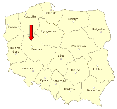
Poland 1945-1975
Slupca district, also called
Slupca county, was in Poznan Province, marked with an arrow. In 1975 the province boundaries were
redrawn and reduced to 16 provinces.
They look like this today
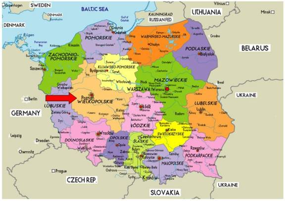
Poland 1975-present
Today Slupca district is in
Wielkopolskie Province.
Wielkopolskie Province is divided in districts, or counties (powiat in Polish).
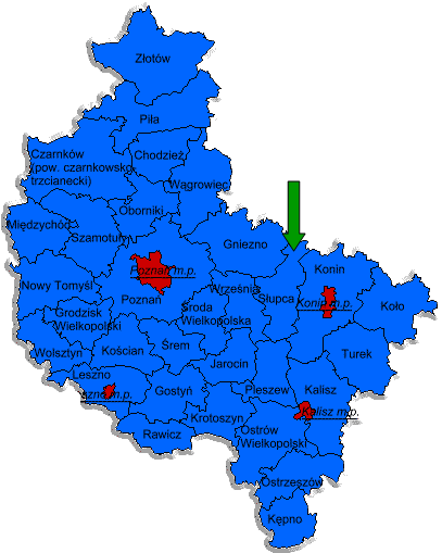
Wielkopolskie Province
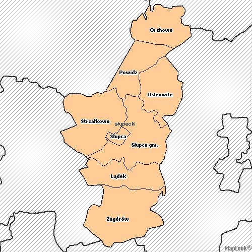
And Slupca district is
divided in municipalities (gmina in Polish), as shown on this map. The Family History Library has the
records for the municipalities of Orchowo in Mogilno district, and Powidz in
Gniezno district, neither in Slupca.
Those records will not be indexed here.
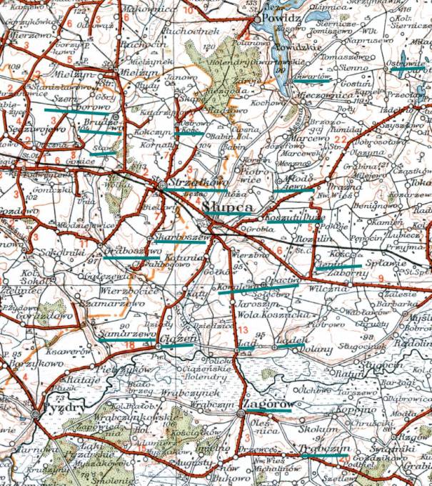
Slupca District
According to the FHL holdings,
Slupca district has 20 parishes; Brudzewo, Cienin Kościelny, Ciążeń, Giewartów,
Graboszewo, Koszuty, Kowalewo, Lądek, Młodojewo, Ostrowo Kościelne, Samarzewo,
Staw, Strzałkowo, Szemborowo, Słupca, Trąbczyn, Zagórów, Łąd, and Skarboszewo. They are underlined on this map. Over time, I hope to index more of
them.
Click here for a
more detailed map of this region.